Medieval Urbanization between Ecclesiastical and Secular Lords
If one takes a look at the urban development of Brandenburg an der Havel, the medieval settlement picture is characterized by a versatility that can hardly be found in any other municipality in the Mark Brandenburg region. This is not least due to the interests of various actors who tried to gain a foothold in Brandenburg in connection with the medieval land development east of the Elbe. For ecclesiastical and secular lords alike, the advancement of municipal development was an important instrument of lordly penetration of the space they claimed. The medieval urban development in Brandenburg an der Havel vividly reflects the intentions, planning and measures associated with this.
The foundation of Brandenburg was by no means from wild roots. Rather, the urban development was based on Slavic settlement structures, at the top of which was the later so-called Pribislav Castle, named after the last Slavic prince to reign here, which had its place on today’s Dominsel (Cathedral Island). When Pribislav died in 1150, he had already found his final resting place in a Christian chapel connected with the castle.
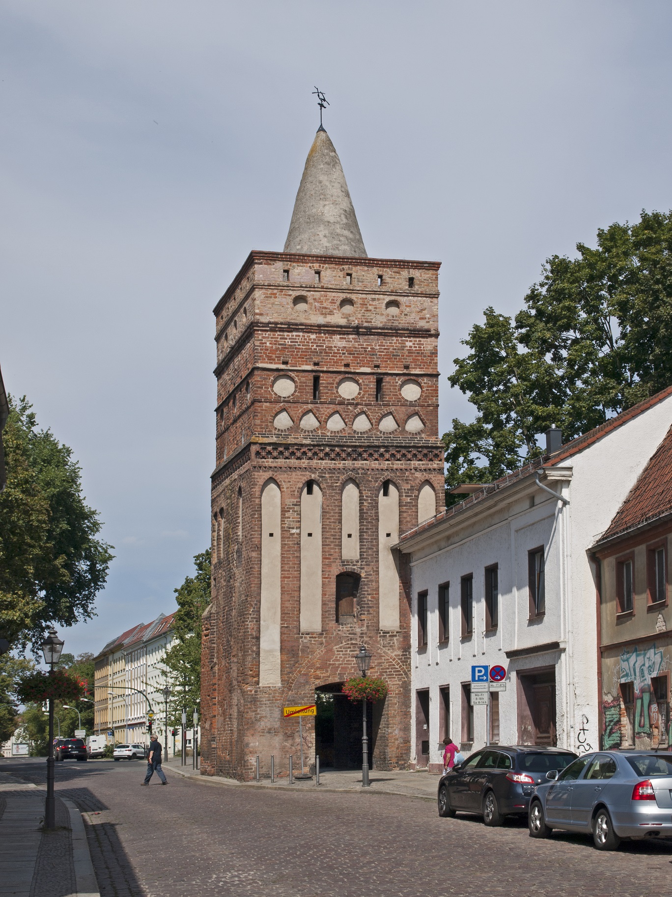
Fig. 1: The Rathenow Gate Tower, completed around 1320, is one of the medieval fortifications of Brandenburg’s old town.
Now the burgraves expressed their claims more and more offensively, intending to exercise lordly power over the Dominsel and beyond in the name of their lord – the Roman-German king. However, with the Ascanians, who from 1157 onwards rose to become margraves of Brandenburg, they encountered powerful competitors who pursued their own lordly ambitions in the vicinity of the Dominsel. In fact, older Slavic rights extended beyond the local castle, since four settlements were connected with the seat of power, which persisted through the Slavic period and around which the settlement pattern gradually changed. These are the small and large Domkietz (Cathedral Neighborhood) on the Dominsel, the altstädtischer (Old Town) or Wendkietz in the area of the Altstadt (Old Town) Brandenburg and the neustädtischer (New Town) Kietz in front of the Neustadt (New Town) on the Mühlendamm (Mill Dam). These designations trace back to settlement structures that developed with the influx of newcomers from the region of the Elbe and Saale rivers in the 12th century. The earliest settlement of the immigrants was Parduin (pronounced pardūn), which was established on royal territory around 1160 and later developed into the Altstadt of Brandenburg. The first traces of this settlement are documented in the surroundings of the church of St. Gotthard, where a group of Premonstratensians from Leitzkau had already settled around 1147.
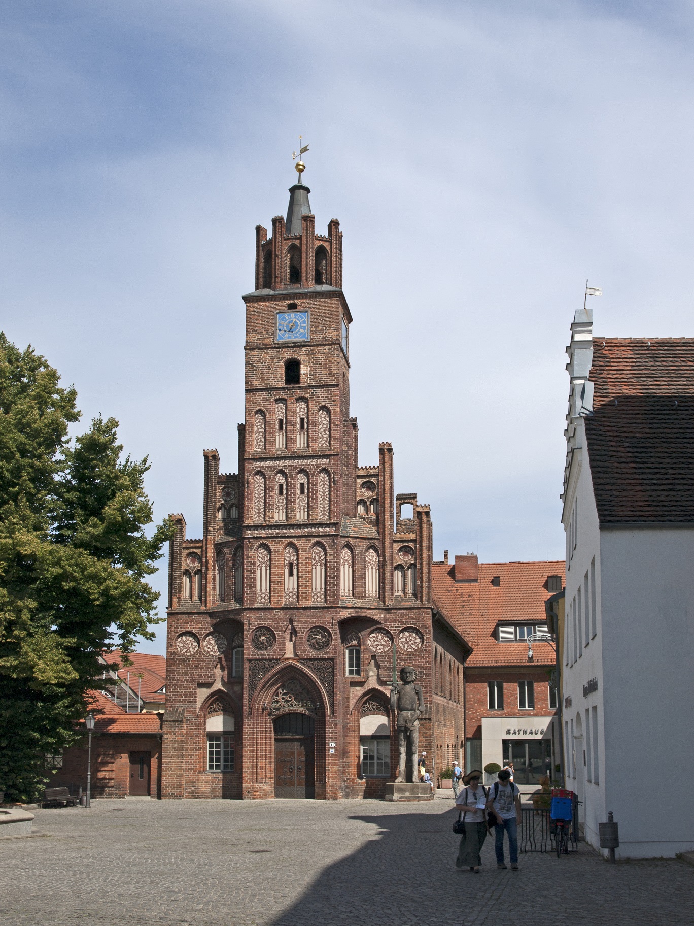
Fig. 2: Town Hall of Brandenburg’s Old Town, with the 15th-century Roland statue in front of the building. The statue was moved here from Brandenburg’s New Town in 1946.
The reform-oriented monks were intensively engaged in Christian missionary work and pastoral care, far beyond Parduin. Especially the new settlers working as merchants moved to their vicinity, and St. Gotthard served them as a parish church. Soon the Bishop of Brandenburg, Wilmar, appointed the convent of the Premonstratensians to cathedral chapter. Their relocation to the Dominsel followed in 1161. Four years later, the construction of the cathedral began, which was to replace an older cathedral church located near the castle. St. Gotthard developed into the parish church of the settlement Parduin. Its name comes from an old branch of the Havel of the same name, which can be translated into Dutch as “strong mooring rope”, and refers to the important role of water in the local urban development. The Havel, namely, marked the lordly border between the royal territory belonging to Havelland, on which the settlement of Parduin was located, and the Zauche, which belonged to the Ascanian estate. Around 1170, a new settlement was established here on the other bank of the Havel on parts of the Stutzdorf/Deutschendorf district, which was first mentioned in documents under the name Neustadt Brandenburg in 1197. This first municipality, founded east of the Elbe by the margraves of Brandenburg, began to outstrip the Altstadt, as it was called from then on, in economic terms through targeted promotion. This was achieved not least with the help of a systematic expansion of urban infrastructure, which can still be seen today in the town’s layout. As in other municipalities in the Mark Brandenburg, a Mühlendamm was raised during the first half of the 13th century, which connected the Neustadt with the Dominsel. This structure dammed the Havel River to be able to drive water mills. In addition, the Mühlendamm was an important transport route that bridged several Havel islands and reached solid land at Krakau, a district that is now incorporated into the town. A large part of the land transport between Magdeburg and Berlin (Spandau) or further in the direction of Posen and Silesia, which was directed to the Neustadt of Brandenburg with the help of the Mühlendamm, passed through here. The medieval layout of the town is characterized by a conspicuous crossroads, which converged from four directions directly at the Neustadt market. Thus, the main street offered a connection to the Altstadt in extension over the Lange Brücke (today’s Jahrtausendbrücke, Millennium Bridge), which probably dates back to the 10th century, and from there on to Rathenow.
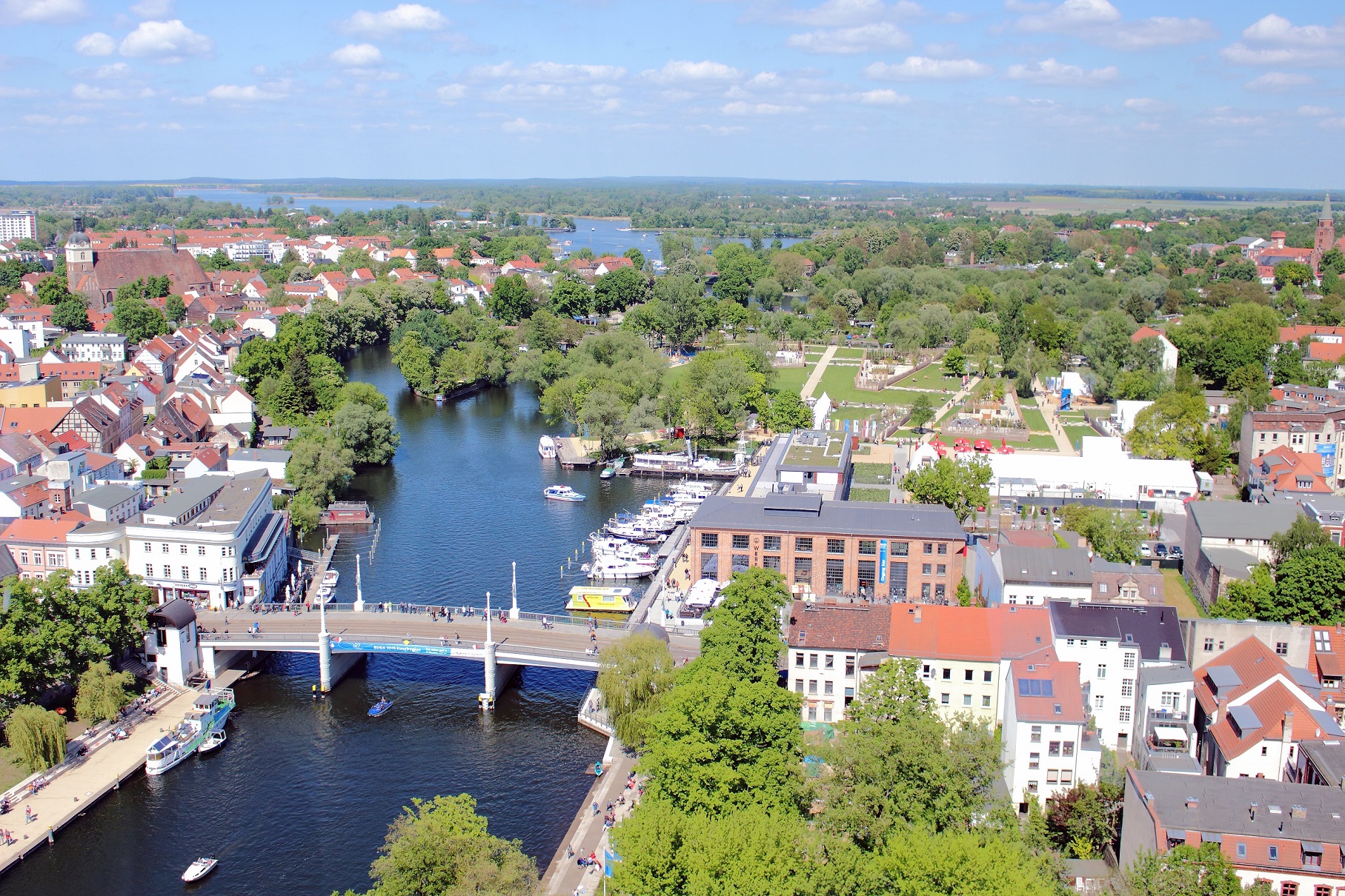
Fig. 3: Brandenburg an der Havel with the Millennium Bridge, an important landmark of the city. Inaugurated in 1929 to commemorate the city’s millennium, it stands on the site of the Lange Brücke, a bridge whose history dates back to the Middle Ages (photo: 2015).
The Sankt-Annen-Strasse, for its part, conveyed traffic into the Zauche, while the Steinstrasse received the country road leading from the Elbe and Magdeburg. The layout of the Neustadt clearly shows the pattern of a town laid out according to plan in the Middle Ages, with a concentration on trade and commerce. The citizens of Neustadt had their own parish church, St. Catherine. From 1286, St. Paul’s Church was built on the site of a margravial farm, which belonged to the monastery of the Dominicans who had moved to the town shortly before. Not least, the existence of this mendicant order marked the economic success of the Neustadt, whereupon the town foundation planned by the Archbishop of Magdeburg in Wusterwitz stagnated. The development of the Altstadt of Brandenburg was also outstripped by the Neustadt. Only when it was able to eliminate the influence of the competing burgraves in the 1240s did the Brandenburg margraves begin to specifically promote the Altstadt by allowing a planned expansion of the Altstadt area. This was followed in 1249 by a transfer of the villages of Luckenberg, Blosendorf and Kallenberg to the Altstadt, with the population living there being declared citizens of the town. During the expansion of the town, the settlement house of the Franciscans, who had been living there since 1234, and their St. John’s Church, which was under construction, were also integrated into the Altstadt. The incorporation of Brielow and Wendkietz followed in 1290 and 1308, respectively. With the support of the Ascanians, the Altstadt, with its parish land, had extended itself as far as Lake Quenz. The Neustadt, which initially did not have a parish land, was also able to extend its influence to the surrounding area and take possession of the villages of Planow, Stenow, Kietz Woltitz, Krug Krakow, Gröben, Schmölln, Wendgräben and Duster-Reckahne.
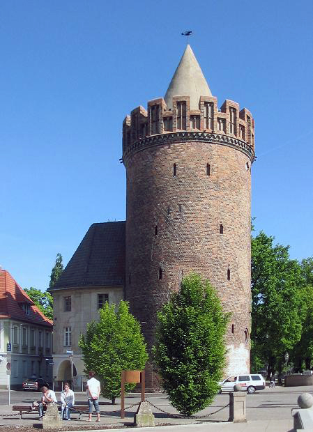
Fig. 4: The Steintor Tower in Brandenburg’s New Town, built in the first half of the 15th century.
The fortification of both towns, which began in the first half of the 14th century, with its buildings that still characterize the townscape today, such as the Steintorturm (Stone Gate Tower) and the Mühlentorturm (Mill Gate Tower) in the Neustadt and the Rathenower Torturm and Plauer Torturm in the Altstadt, visibly marked for every medieval contemporary the narrower boundaries of municipal law, which was exercised in Brandenburg according to the Magdeburg model. Even more, they illustrated the defensive character of both town councils, which had separately meeting town councils and town halls built on the respective market squares. For shared interests, however, a common town hall existed, similar to that in the twin city of Berlin-Cölln, which was first mentioned in 1360 and stood on the Lange Brücke. The Neustadt, however, remained the more important of the two municipalities. This can be seen not least in the fact that under Margrave Johann it was appointed the highest thing town in his dominions in questions of interpretation of the town law. In the course of the 14th century, this resulted in a claim to validity for the entire Brandenburg Margraviate, which was intended to prevent Magdeburg’s aldermen from giving information and passing judgment.
The aforementioned water mills between the Altstadt and Neustadt Brandenburg were indispensable for the trade of both towns. Ultimately, shipping on the Havel also had a lasting impact on Brandenburg’s urban development. Already with the construction of the Mühlendamm, the building of a flood channel began, which directed the shipping traffic in a generous curve around the Neustadt. Here, customs duty had to be paid, a procedure that can be found in the documents with the paraphrase “etwas zu verrönnen” (“something to channel through”). The shipping route, which still exists today with the Jakobsgraben (Jacob’s Ditch), only gradually lost its importance in the middle of the 16th century with a new expansion of the Havel and the construction of the Kammerschleuse (Town Lock). The developments of the medieval city of Brandenburg, which are only mentioned here in broad outline, can still be found today during attentive walks through the historic town center.
The article is a slightly revised version of the essay by Sascha Bütow, Urbanisierung zwischen geistlichen und weltlichen Herren – zur Entwicklung der Stadt Brandenburg an der Havel im Mittelalter, in Die Mark Brandenburg, no. 111 (2018), pp. 10–15.
Author: Sascha Bütow
Citation:
Sascha Bütow, Brandenburg an der Havel. Medieval Urbanization between Ecclesiastical and Secular Lords, 21.09.2020, https://magdeburg-law.com/historic-city/brandenburg-havel/
Further Reading:
Harald Bodenschatz and Carsten Seifert, Stadtbaukunst in Brandenburg an der Havel. Vom Mittelalter bis zur Gegenwart, Berlin 1992.
Friedrich Ebel, Brandenburg und das Magdeburger Recht, in Beiträge zur Entstehung und Entwicklung der Stadt Brandenburg im Mittelalter, edited by Winfried Schich, Berlin 1993, pp. 157–174.
Joachim Müller, Brandenburg an der Havel. Von der Frühstadt zur Planstadt, in Lübecker Kolloquium zur Stadtarchäologie im Hanseraum, vol. X, Vorbesiedlung, Gründung und Entwicklung, edited by Manfred Gläser, Lübeck 2016, pp. 321–338.
Joachim Müller, Brandenburg an der Havel. Altstadt und Neustadt, in Führer zu archäologischen Denkmälern, vol. 37, Potsdam, Brandenburg und das Havelland, Stuttgart 2000, pp. 230–237.
Winfried Schich, Die Bedeutung von Brandenburg an der Havel für die mittelalterliche Mark Brandenburg, in Wie die Mark entstand. 850 Jahre Mark Brandenburg, Fachtagung vom 20. bis 22. Juni 2007 in Brandenburg an der Havel, edited by Joachim Müller, Klaus Neitmann and Franz Schopper, Wünsdorf 2009, pp. 431–451.
Images:
Figs. 1–4: Wikimedia Commons, CC BY-SA 4.0 (Fig. 4: Lienhard Schulz).