City Foundation with Infrastructure Planning – Frankfurt an der Oder and the Berlin City Law
In 1253, Frankfurt an der Oder received the Berlin, actually, Magdeburg law, about which numerous accounts with different focuses have been published.[1] It must be emphasized that Frankfurt’s city charter reveals comprehensive infrastructural planning, the effects of which are still tangible today. If one follows the text of the charter, which is available in several editions, the inhabitants, under the direction of Gottfried von Herzberg, had the task of establishing a market, on which the construction of a merchant’s or city hall was allowed to take place. This included other buildings such as stalls, benches, and shacks, which were to serve as sales stalls. Another building in the planning stage was the bridge over the Oder River. Its construction undoubtedly cost the town’s founders a great deal of effort, both in terms of material and labor. The expenses were borne solely by the emerging citizenry. However, in return, the Brandenburg Margrave Johann allowed the levying of a toll, which could be collected from every user after the completion of the bridge. This constituted the material basis of a do-ut-des (I give so that you give) principle, according to which the efficiency of transport infrastructures was to be guaranteed. Although, in reality, such revenues were often misappropriated, the duty must by no means be reduced to a mere “trade charge”.
The buildings, which were important from an infrastructural point of view, also included mills, which the city’s school superintendent was allowed to build and which tied the surrounding area to Frankfurt in a lasting way. In the vicinity of the planned bridge, the inhabitants built a harbor, which – contrary to what the term suggests – probably consisted of several landing places where ships could sail onto the shore. With these and other rights, the infrastructural and economic basis of the new market city on the Oder River was established. In addition, Frankfurt, which was erected in cooperation between the margrave and his subjects, served to develop and map the area, as the merited regional historian Winfried Schich has pointed out on several occasions.[2] With Frankfurt, the Brandenburg margrave intended a lordly permeation and consolidation of his power. If this was to succeed, the settlement had to become a fixed point of traffic by means of appropriate support, thus demonstrating in Frankfurt the fundamental connection between the founding of the city and its influence on the development of the road network.[3] The success of this planning can be illustrated by the road map drawn by Erhard Etzlaub in 1501, which impressively depicts Frankfurt’s position within a Europe-wide traffic route network with over 800 cities.[4]
It is from this perspective that Frankfurt’s situation must be understood: Until the end of the Middle Ages, sovereign support and the commitment of the city council had created a compulsory point of traffic. Rights of way, customs and staple rights extended far into the surrounding countryside and directed traffic toward Frankfurt. To reduce this to urban egoism alone, as has often been done in research, would at the same time mean ignoring the origins and development of these structures back to the granting of city rights. In fact, the actions of the Frankfurt council went beyond mere self-interest, as evidenced, for example, by the alliances of cities concluded several times between 1308 and 1438. The legal powers of the Frankfurt council had gradually extended to the surrounding countryside. In 1399, for example, the city of Frankfurt committed itself to ensure the safety of traffic routes “vnsen gnedighen heren vnde syne lande zu ghude” (“benefiting our gracious lord and his country”).[5]
This aspiration was indeed followed by action, in that peacebreakers and highwaymen were pursued. Often, after their capture, they were interrogated and sometimes judged in Frankfurt. One example is Hans von Bomsdorff, who was beheaded in Frankfurt on June 12, 1503, after being sentenced by the council and the aldermen.[6] His older brother Andreas subsequently feuded with the city of Frankfurt on several occasions from his ancestral seat of Grano near Guben. From the year 1505, for example, we learn that he attacked the son of the Frankfurt mayor Nikolaus Kune on a trip to Lübben and captured a large sum of money.[7] In many cases, Frankfurt, together with other cities, but also in alliance with princes, instigated a proper trial against the perpetrators. In 1506, Andreas von Bomsdorff and some of his allies were finally convicted in this way. Their trial took place in Sagan (Żagań) in Silesia, where the Frankfurt council sent several representatives to witness the reaching of the verdict and the subsequent beheading of the offenders.[8]
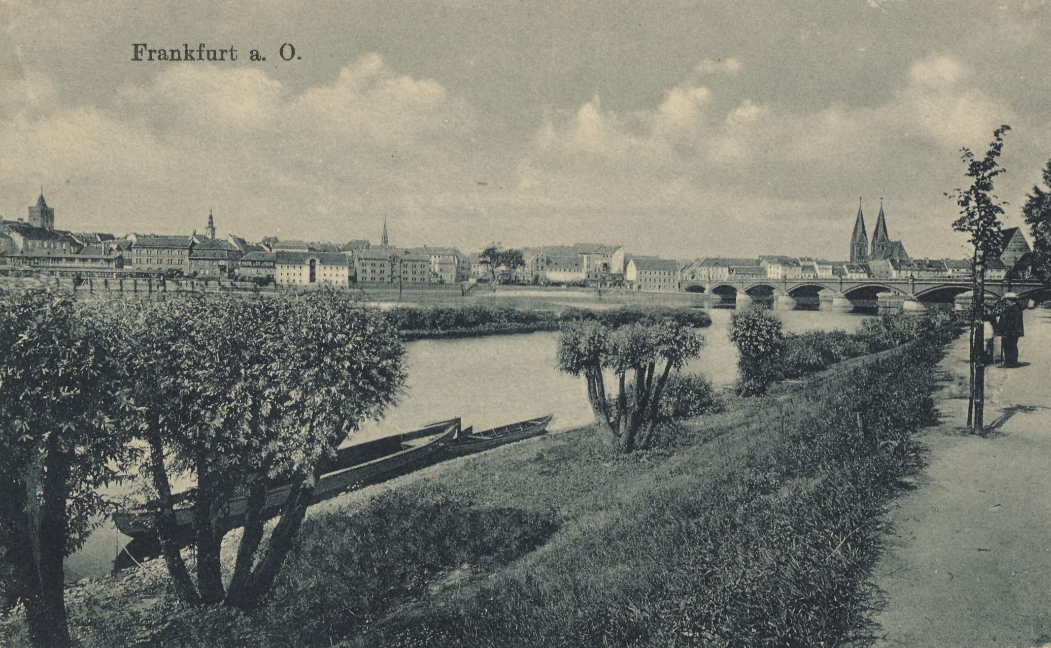
Fig. 1: Recolored woodcut of a view of the city of Frankfurt an der Oder dating from 1548. With the participation of Berlin citizens, Frankfurt was transferred the Berlin law in 1253, which was based on the general Brandenburg city law and had its origin in Magdeburg. In the 16th century, Frankfurt was one of the wealthiest cities in the Margraviate of Brandenburg.
Although these examples certainly underscore Frankfurt’s influence on the traffic route network and its users, the city was hardly as selfish as is often claimed. This includes the fact that the city’s staple right was by no means binding on every transport route user, either because they simply ignored it or because they enjoyed corresponding freedoms. The important Berlin Oder trade, for example, very often bypassed Frankfurt and instead headed for Oderberg or also Schwedt.[9] The same can be observed with regard to the Oder shipping, for which the city council was also hardly able to comprehensively enforce the staple right. Thus, the Frankfurt city scribe Nikolaus Teymler reports in his records of transhipment operations on the river to the detriment of the staple rights of his hometown.[10] But the Frankfurt council itself also granted various people the privilege of free passage, such as Hermann Palitz, a citizen of Greifswald, who sailed to Guben in 1372.[11]
In summary, it can be stated that the power of the Frankfurt council was definitely limited. In 1509, for example, Elector Joachim I clearly reserved the right to decide for himself all disputes “von engerung oder verpawung des freyen stroms und der Scheffart uff der oder” (“concerning the narrowing or damming of the free river and the shipping on the Oder”), although he acknowledged the city’s share of responsibility.[12] This important role of Frankfurt was based to a considerable extent on the city charter received in 1253, which took local infrastructure planning with its effect on the surrounding area into account from the very beginning.
Fig. 2: Since the Middle Ages, the city of Frankfurt profited from the Oder trade. An important means of transport was the barge, the design of which hardly changed over the centuries. Postcard from around 1900.
Author: Sascha Bütow
Citation:
Sascha Bütow, Frankfurt a. d. Oder. City Foundation with Infrastructure Planning – Frankfurt an der Oder and the Berlin City Law, 16.12.2021, https://magdeburg-law.com/historic-city/frankfurt-oder/
Footnotes:
[1] On the discussions about the Frankfurt City Letter, cf. most recently Monika Kilian-Buchmann, Frankfurt (Oder) im 13. und 14. Jahrhundert. Untersuchungen zur Bevölkerungsstruktur und Siedlungsentwicklung, Jacobsdorf 2008 (Frankfurter Jahrbücher 2008/2009), pp. 113-114.
[2] Recently on this Winfried Schich, Von Frankfurt an der Oder nach Landsberg an der Warthe. Die Anfänge der markgräflichen Städtegründungen in der Neumark unter Johann I. und Otto III., in Landesherr, Adel und Städte in der mittelalterlichen und frühneuzeitlichen Neumark, edited by Klaus Neitmann. Berlin 2015, pp. 183–212.
[3] In general on this Dietrich Denecke, Straßen und Weg im Mittelalter als Lebensraum und Vermittler zwischen entfernten Orten, in Mensch und Umwelt im Mittelalter, edited by Bernd Herrmann, Stuttgart 1986, pp. 203–219, especially pp. 206-207.
[4] Sascha Bütow and Benjamin Schwuchow (reviser), Die Nieder- und Oberlausitz im Bild historischer Karten, edited by Heinz-Dieter Heimann and Klaus Neitmann, Berlin 2014 (Studien zur brandenburgischen und vergleichenden Landesgeschichte 15), pp. 14–15.
[5] Codex Diplomaticus Brandenburgensis. Sammlung der Urkunden, Chroniken und sonstigen Quellenschriften für die Geschichte der Mark Brandenburg und ihrer Regenten, edited by Adolph Friedrich Riedel, series A–D, 41 volumes, Berlin 1838–1869, here series A, vol. 24, no. XCVI, pp. 393-394, here p. 393.
[6] Richard Jecht, Görlitzer Acheldemach aus den Jahren 1498-1513, in Neues Lausitzisches Magazin 85 (1909), pp. 108–216, here p. 167.
[7] Ibid., p. 132.
[8] Ibid., p. 139.
[9] Herbert Helbig, Gesellschaft und Wirtschaft der Mark Brandenburg im Mittelalter (Veröffentlichungen der historischen Kommission zu Berlin 41), Berlin, New York 1973, pp. 92-93.
[10] Same as note 5, series A, vol. 23, no. CDXVII, pp. 380–422, here p. 383.
[11] Ibid., no. CLIX, p. 111.
[12] Codex Diplomaticus Brandenburgensis Continuatus, edited by Georg Wilhelm von Raumer, 2 volumes, Berlin, Stettin, Elbing 1831–1833, here vol. 2, no. XXII, p. 235.
Images:
Fig. 1: zeno.org (in the public domain)
Fig. 2: wikimedia commons, photo: Willi Wallroth